From the period that rice-growing was brought to Japan approximately 3,000 years ago, right up to the present day, our ancestors toiled to find a way to grow a large amount of rice on narrow terrain.
Japan is described in the Kojiki, a record of the country’s development into a nation, as the “Country of Lush Reed Plains,” a reference to the bountiful growth of rice and an indication of how rice has symbolized Japan since ancient times.
In this corner, we will introduce you to Toyama’s diverse rice culture through its history, culture, and beautiful natural scenery.
“The view from Utagaki Park (Shiroishi Plains).” Photo courtesy of the Saga Prefectural Tourism Federation.
Long ago, this region was mentioned in the Nihon Shoki (the second oldest book in Japanese classical history) as “The Land of Fire,” due to the legend of Shiranui ghost lights over the sea, and also as “The Fertile Land.” In documents from the late 7th and early 8th centuries, it is also referred to as Hizen and Higo, both names derived from its fertility. The etymology of “Saga,” according to the Hizen Fudoki (an ancient report on the province of Hizen), derives from a story of a visit by Prince Yamato Takeru. When he laid eyes upon the region’s flourishing camphor trees, he called it “saka no kuni” (the land of prosperity).
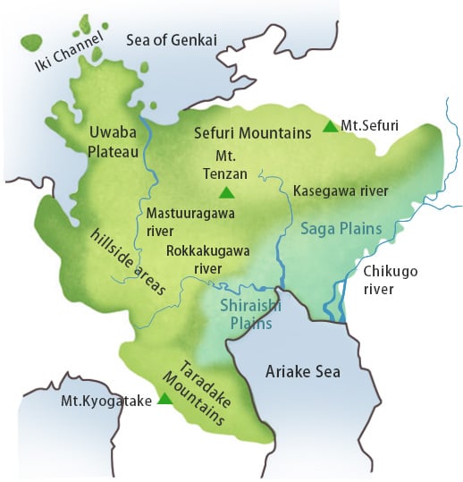
The topography of the prefecture can be largely divided into thirds.
The fountainhead region toward the plains in the Mt. Sefuri area, bordering Fukuoka Prefecture.
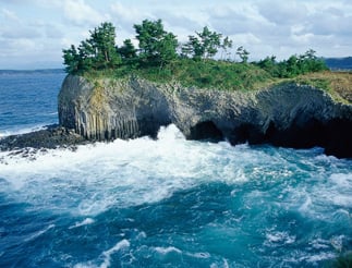
A coastline rich in diversity in the western hilly area, where the Eastern Matsuura Peninsula (Uwaba Plateau), rooted in the city of Karatsu, protrudes significantly over the Genkai Sea. Turning southeast from there, there is a continuous region of gently rolling hills leading to the Mt. Taradake area.
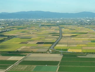
The Saga Plains, which face the Ariake Sea to the south and continue toward the southwestern part of Fukuoka Prefecture, making up the western half of the Tsukushi Lowlands. These fertile alluvial plains are formed by the Chikugo River (also known by the human-sounding name Chikugo Jiro), the Kasegawa River, and Rokkakugawa River.
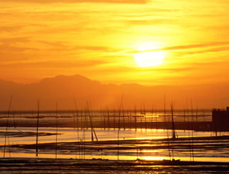
“Nanatsugama Caves (Yobuko Town, Karatsu City).” Photo courtesy of the Saga Prefectural Tourism Federation.The Saga Plains. “The scenery of the Ariake Sea.” Photo courtesy of the Saga Prefectural Tourism Federation.
With an average annual temperature of about 16°C, the climate is comparatively temperate. It averages 1800 mm of rainfall annually, more than the natural average, and as much as 2500 mm in the mountainous areas. Sandwiched between the good fishing grounds along the Genkai Sea’s Tsushima Warm Current and the Ariake Sea, which has the most extreme tidal variation in Japan, there is a creek (waterway or canal) with a total length of 2000 km winding through the plains area.
Culturally speaking, the prefecture can be largely divided into two parts, along north-south lines. One part is the Saga area, which was once under the direct control of the Nabeshima domain. This area is oriented around simplicity and fortitude, discipline, and stability, as exemplified by the Hagakure Spirit (a practical and spiritual guide for warriors). The other is the Karatsu area, whose control frequently shifted between different domains, providing the roots for a free and easy character, as well as a thriving townsman culture.
The porcelain of Arita and Imari took the world by storm, and the hot springs of Takeo and Ureshino also have history as famed tourist spots dating back 1300 years.
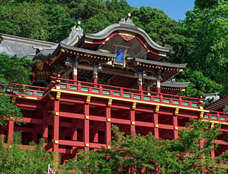
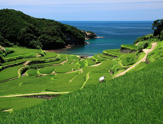
“Yutoku Inari Shrine (Kashima City).” Photo courtesy of the Saga Prefectural Tourism Federation. “The Karatsu Kunchi Festival (Karatsu City).” Photo courtesy of the Karatsu Tourism Association.“The terraced rice paddies of Hamanoura (Genkai Town).” Photo courtesy of the Saga Prefectural Tourism Federation.
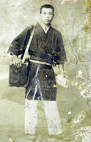
Column.1 The patent medicine sellers of Tashiro and Kiyama
During the Edo period (1603-1868), the areas now known as Tosu and Kiyama, which could not produce rice, were detached territories of the Tsushima domain (Tashiro territory), and the land tax was a large financial burden. Farmers there developed a side business of using ginseng and other herbal medicines obtained through trade with Korea to produce and sell patent medicines. There are records of their sales in Hakata as well during the Horeki period (1751-1764). From the last days of the Tokugawa shogunate to around the Meiji period (1868-1912), the sphere of commerce spanned from the entire island of Kyushu to the Chugoku region.
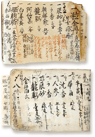
“A patent medicine seller’s clothing.” Photo courtesy of the Kiyama Town Board of Education.* A ledger of prescribed medicines recorded during the Edo period (1603-1868). Top: “A Record of Medicines” (1817). Bottom: “The Seven Secret Remedies,” (1850) (Property of the Kiyama Town Board of Education).
“The flooded rice paddies of the Shiroishi Plains.” Photo courtesy of the Saga Prefectural Tourism Federation.
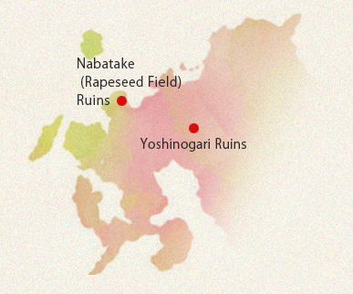
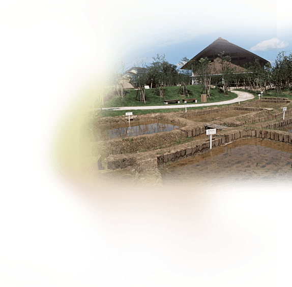
The Nabatake Ruins
The Nabatake (Rapeseed Field) Ruins are a relic showing the evolution of the wet rice farming conducted in the hilly valleys from the latter half of the Jomon period (c. 10th century BCE) to the mid Yayoi period (from the 4th century BCE to about 1 CE). These are thought to be the oldest ruins of rice paddies that can be seen in Japan today.
“Excavated carbonized rice.”“The reconstructed rice paddies of the Nabatake Ruins.”
Photos courtesy of the Karatsu City Board of Education.
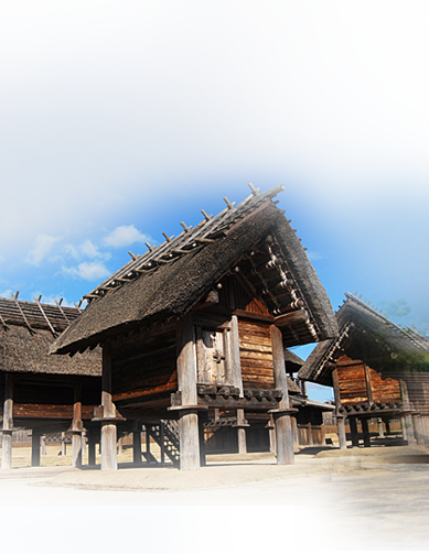
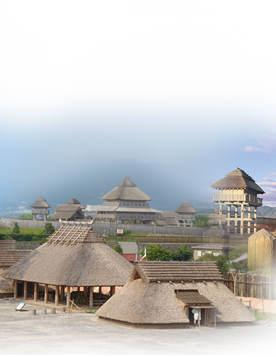
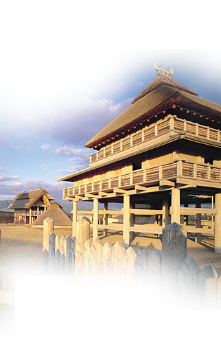
The Yoshinogari Ruins
The Yoshinogari Ruins are Japan’s largest moated settlement, a structure that developed during the Yayoi period. This historic site shows the process of evolution to a society built mainly on rice farming. A rural community formed from the early Yayoi period (c. 5th century BCE) onward, and then developed into a moated settlement estimated at 20 hectares or more during the mid Yayoi period, from about the 2nd to 1st century BCE. The appearance around this time of over 40-meter-long funkyubo (tombs embedded in Yayoi-period mounds), bronze swords, tube-shaped glass beads, and other burial implements indicate the birth of a king.
By the late Yayoi period (1st to 3rd century BCE), the scale of the settlement exceeded 40 hectares. At the time, it was reminiscent of a Chinese walled city, securely protected by structures such as a moated settlement, fenced castle, and watchtower. Inside its walls could be found the seat of the government, religious sites, workshops, trading markets, dwelling places, and more.
“Yoshinogari Historical Park (Kanzaki City and Yoshinogari Town).”
Photo courtesy of the Saga Prefectural Tourism Federation.Photo courtesy of the Saga Prefectural Tourism Federation.Photo courtesy of the Saga Prefectural Tourism Federation.
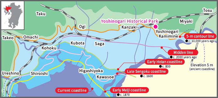
“The evolution of the coastline.” Image courtesy of the Kyusyu Regional Agricultural Administration Office.
The Ariake Sea has tidal variations of up to 6 to 7 meters. The sediment carried by the Chikugo River and other rivers flows out to sea briefly, but then at high tide, countercurrents bring its back toward the coast, where it accumulates. People have long worked to improve the gradually expanding tidal flats, making them into land suitable for agriculture. This led to the development of unique agricultural techniques such as creeks and land reclamation. From the kaizuka (shell midden sites), we can surmise that about 10,000 years ago, the location of the Yoshinogari Ruins was close to the coastline.
“The creek in the Anegawa Castle Ruins (Kanzaki City).” Photo courtesy of the Kanzaki-city Tourism Association.
*Valuable ruins that can show the occurrence and composition of rural agricultural communities, feudal lords, and samurai during the middle ages.
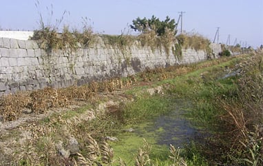
Oogarami Dike (Higashiyoka Town, Saga City).
Source: Doboku Isan in Kyushu, Kyushu Chiikizukuri Kyoukai http://dobokuisan.qscpua2.com/
* The largest-scale reclamation dike on the Ariake Sea coast from the early Meiji period (1868-1912).
The Saga Plains had always suffered from water shortages, as there are few large rivers in the area. However, because it is only 5 m above sea level, it has also experienced frequent water disasters due to the overlapping of heavy rains, typhoons, high tide in the Ariake Sea, or flooding in the Chikugo River. For this reason, the winding moat, a unique irrigation work, was developed from the Nara period (710-794) onward, and until the Sengoku period (1467-1615), all areas enjoyed an irrigation system that allowed free and unfettered access to water.
It was Shigeyasu Naritomi who, amidst such circumstances, built the foundation for the Nabeshima domain’s irrigation works. His efforts created not only the flood control works in the Saga Plains, flood prevention works in the Chikugo River, and coastal works premised on reclaimed land from the Ariake Sea, but also almost the entirety of the outline of water usage today. They also more or less accounted for the municipal and agricultural planning aspects of territory management in the establishment of the Shogunate system.
(1560-1634)
Shigeyasu Naritomi served Takanobu Ryuzoji, and father and son Naoshige and Katsushige Nabeshima, as a variety of roles of military service in the form of battles, castle-building, diplomacy, land surveying, and more.
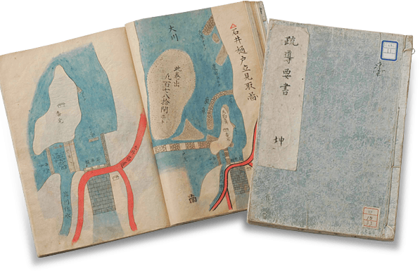
“Canal map” (Sketch of Ishiibi). Property of the Museum Chokokan Nabeshima, Nabeshima Houkoukai / Loaned by the Saga Prefectural Library
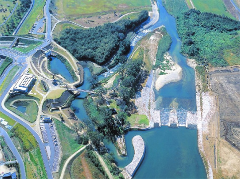
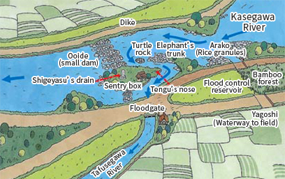
“Modern-day Ishiibi Park.” Photo courtesy of the Chikugo River Office.“The structure of Ishiibi.” Image courtesy of the Kyusyu Regional Agricultural Administration Office.
The river has a tendency to accumulate a large amount of sand particles from the granite layer of the Mt. Sefuri range, so this facility was introduced to separate out the sand from the water and thereby create a stable supply of water for inside Saga Castle and the downtown area around the castle. It is said to have been constructed during the Genna period (1615-1624).
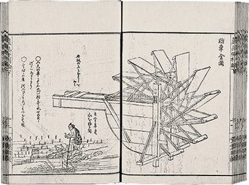
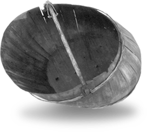
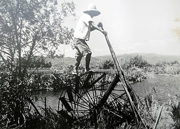
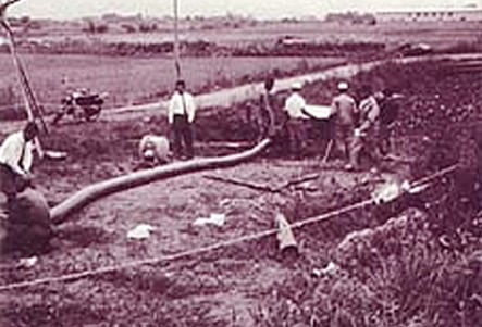
1 Lift irrigation from a low-lying moat.
Pumping water used to involve tough physical labor, whether with ancient water pumps in ancient times or the treadmill waterwheels used from the Edo period (1603-1868) onwards. This inspired the expression “Neither the new year nor the Obon festival is as joyful as rain.”
“Pumping water with a tub-filling bucket (Discourse on the Convenience of Agricultural Tools, Vol. 3).” Property of the National Diet Library, Japan.“Diagram of an agricultural treadmill (Discourse on the Convenience of Agricultural Tools, Vol. 3).” Property of the National Diet Library, Japan.
“A tub-filling bucket that was actually used.” *“An agricultural treadmill.” *
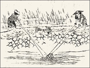
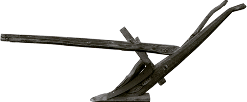
2Horse-plowing of flooded rice paddies
Horse-plowing of flooded rice paddies was a unique cultivation method intended to prevent the leakage of valuable water. Special ploughs were used to prevent soil cracks and harden the plowsole through kneading.
“A plough for flooded rice paddies.”*
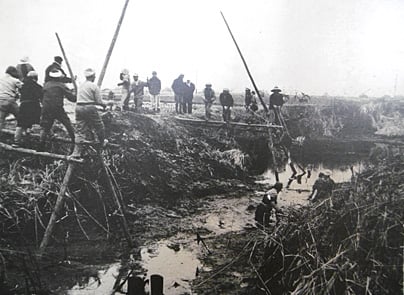
3Mud digging
In the winter months, mud pumping work was used to deepen and widen the moat. When it came time to transplant rice seedlings, it was possible not only to save valuable water but also to use the pumped mud as a superb fertilizer to nourish the paddies.
“Mud digging (recreated c. 1972).” *
* Photo courtesy of the Saga Prefecture Agricultural Research Center.
Production of early-ripening Champa rice (indica rice) was prevalent in this area until the Edo period (1603-1868). It is thought that this variety was chosen because of its drought resistance and the dispersion of the busy part of its farming season, ensuring that there would be at least a small harvest every year.
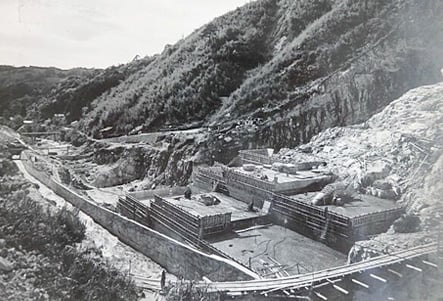
The history of Saga was fraught with water shortages, but this changed with the introduction of electric water pumps in the Taisho period (1912-1926). Further, peasant farmers and the prefecture united to expand production, resulting in the achievement of 417 kg per tan (approx. 991.7 m2) in 1938 (national average: 321 kg).
While the harvest amount did decrease somewhat after that point, post-war it rose again to the highest level in Japan thanks to land improvement works and the construction of the Kitayama Dam. This farming method from Saga came to be called “Saga Dankai” (literally, “Saga steps”) and it has served as a model for agriculture across Japan.
“Drawing water with a pump (Taisho period (1912-1926)).” “The Kitayama Dam under construction (c. 1953).”
Photo courtesy of the Saga Land Improvement District.
From the Mt. Sefuri area to the Ariake Sea coast, mainly in the Saga Plains, white rice was the food of choice for days of celebration. Meals normally consisted of rice mixed with barley or other grains, tea-flavored rice porridge, or noodles such as udon or somen made using off-season wheat crops. Along the Genkai Sea coast, which has few flooded rice paddies, and in the foothills of Mt. Taradake, the staple foods were barley and sweet potatoes.
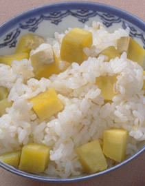
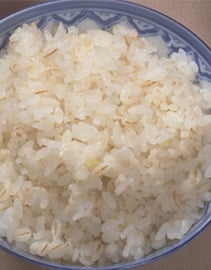
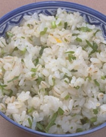
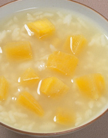
Touimo gohan (rice cooked with sweet potato)Mugimeshi (rice mixed with barley)seri gohan (rice cooked with water dropwort)karaimo-irino chagayu (tea-flavored rice porridge with sweet potato)
Even on the Genkai Sea coast, people conserved rice by mixing it with various grains to make thin soups called zuushi (known as zousui in standard Japanese). Sardines, one of the main fishing industry products, are also commonly eaten.
Dango zuushi (thin rice soup with dumplings)
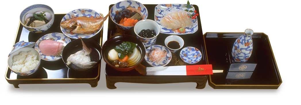
In the Arita and Imari regions, there is a saying “Open the kiln, and you can get money” referring to how their economic power allowed them to buy and eat rice. These areas enjoyed a luxurious food culture, as demonstrated in expressions like “Epicureans from Arita” and “Eat well, even if it sends you to the pawnshop.”
“An Imari-style New Year’s celebration meal.” All photos property of Rural Culture Association Japan.
The seafood culture of Saga Prefecture is also diverse, unlike any other in the world. The Genkai Sea has its fishery products, the Ariake Sea has rich and original fishery products, and the creek that connects the plain to the reclaimed land produces freshwater fishery products.
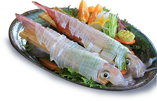
“Preparing squid ikizukuri (live seafood) (Yobuko Town, Karatsu City).” Photo courtesy of the Saga Prefectural Tourism Federation.
1 In areas facing the Genkai Sea, the fishery industry consists mainly of pelagic migratory fish and rocky beach fish (e.g. horse mackerel, mackerel, squid varieties, sardines, amberjack, and sea bream).
“Thoughts on the Products of Hizen Province,” property of Saga Prefectural Museum.
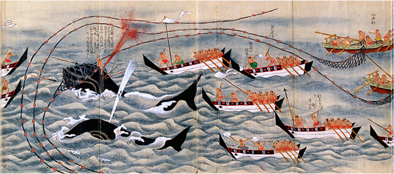
The whaling culture of this area reached its peak during the Edo period (1603-1868). Whale hunting first began in the late Muromachi period (1136-1573) with the organization of merchants in Kishu, and it spread and developed in the Goto Islands, Hirado, and Iki regions. The industry is said to have been established in Yobuko and Ogawashima during the Houei period (1704-1711).
Whale hunts involved groups of nearly a thousand, as shown in the expression “Catch one whale and seven beaches will rejoice.”
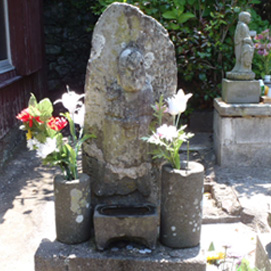
When a whale was caught, it was used in its entirety, with no part going to waste. Whale oil was used to light lamps and as a pesticide for rice-eating pests, and whale bones were powdered for use as fertilizer. A memorial tower was constructed so that those involved in whaling could pray for the souls of the whales.
“Whaling Memorial Tower (Yobuko Town, Ogawashima Island).” Photo courtesy of the NPO Karatsu Hama Net
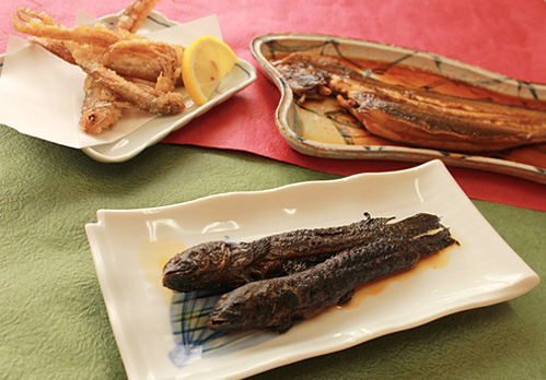
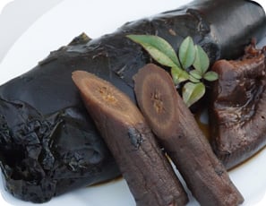
2The Ariake Sea has large tidal flats, which are 5 to 7 km offshore at high tide. The fish and shellfish that dwell there are unusual in shape and appearance, and are known locally as mae-umi mon (near-sea creatures).
“The seafood dishes of the Ariake Sea.” Photo courtesy of the Saga Prefectural Tourism Federation.
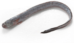
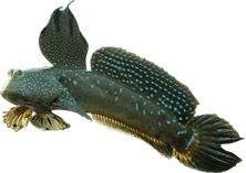
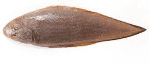
Eel goby.Blue-spotted mud hopper.Red tonguesole.
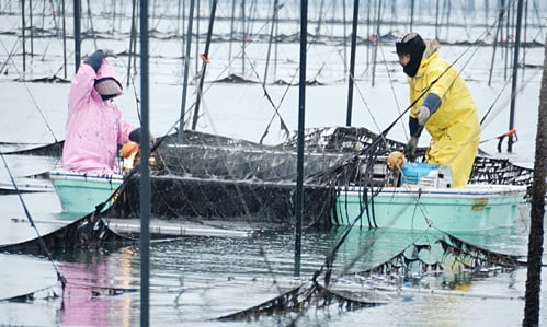
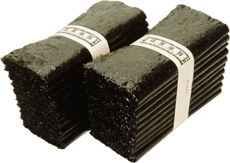
“A view of the nori (laver seaweed) harvest.” Photo courtesy of the Saga Prefecture fishery cooperative federation.“Saga nori (laver seaweed).” Photo courtesy of the Saga Prefectural Tourism Federation.
Nori (laver seaweed) aquaculture began in 1905. At the start, it was a struggle because of the large tidal variations of the Saga area, but the development of aquaculture techniques led to growth from the mid-1950s to mid-1960s and thereafter. In recent years, the area has boasted the largest harvest in Japan.
3In the Saga Prefecture area, the end of the rice harvest meant the start of furrow scooping for moats and irrigation canals.
The pooled mud would be used as compost for the rice fields, serving as a valuable source of wintertime protein for the crucian carp, koi, loaches, pond snails, and other creatures.
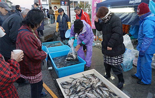
“The scenery of Funa-ichi (crucian carp market) in Kashima City”Funankogui (crucian carp wrapped in kelp and simmered)
Photo courtesy of the Saga Kashima City Tourism Association.
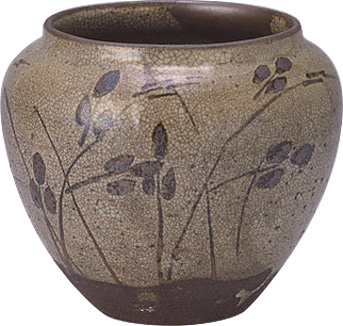
“Jar with underglaze iron-brown design of bush clover” The Kyushu Ceramic Museum, Saga Prefecture.
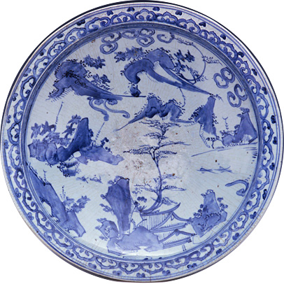
Karatsu ware, which was first begun by the techniques of Korean potters in the late of the 16th century, was such a sweeping success that porcelain came to be called “karatsu mono” in the western regions of Japan. Thanks to their rustic simplicity, fine karatsu ware pieces were produced widely in response to demand for everything from everyday kitchen goods to tea ceremony vessels.
A quality pottery stone was discovered in Arita by the Korean potter, those who were taken by Hideyoshi during his invasions of Korea. The first successful firing of porcelain in Japan took place during the 1610s.
Later, the import of porcelain came to a halt due to civil war in China (the 17th-century transition from the Ming to Qing dynasties), and the influx of techniques from China caused a rise in the quality of domestic products, leading to an increase in production. In addition to demand from the high-consuming city of Edo (now Tokyo), large orders began to arrive from Europe too, serving as a major source of income for the domain.
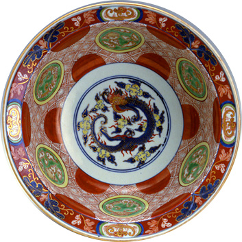
“Large dish with underglaze cobalt-blue design of pavilion and landscape.” The Kyushu Ceramic Museum, Saga Prefecture.“Bowl with overglaze polychrome enamel design of red circles, clouds, and dragon.” The Kyushu Ceramic Museum, Saga Prefecture.
Column.2 A region connected to the development of tea
During the Kamakura period (1185-1333), tea was planted in the foothills of Mt. Sefuri from seeds brought from China by the monk Eisai. It is said that the seeds harvested from these tea fields were later gifted to the priest Myoe of Kosanji Temple in Toganoo, Yamashiro Province (now Kyoto), spreading tea to that region.
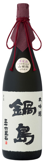
This is an area with a strong culture of sake drinking. In terms of alcohol consumption, refined sake was number one in Saga Prefecture until 1971 (while the top spot nationwide was ceded to beer in 1959). The prefecture also has bars where more than 60% of the refined sake consumed is produced locally. *As of 2014.
Saga’s sake enjoys a good reputation around the world, with Nabeshima being chosen as the champion in the sake category of the 2011 IWC (International Wine Challenge).
“Nabeshima daiginjo sake.” Photo courtesy of Fukuchiyo Shuzo Co., Ltd.
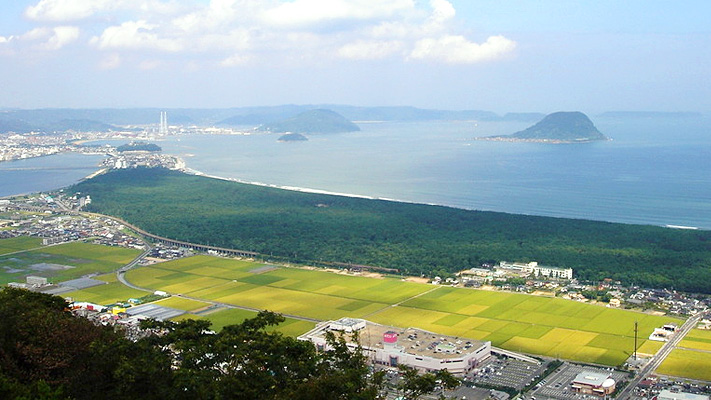
Niji No Matsubara (Rainbow Pine Grove) is one of Japan’s three most scenic pine groves. It was designated as a national scenic area in 1926, and is the only pine grove in the ranks. Back then, it stretched about 6 km east to west and 500 m wide at maximum north to south.
It is said that afforestation with black pines began during the reign of Hirotaka Terasawa, the fourth lord of the Karatsu clan (from 1593), in the aim of protecting the reclaimed arable land facing Karatsu Bay from salt damage caused by the strong sea breeze during the winter months. It takes about 20 years for a black pine to grow sufficiently for these purposes. There are no records of the crop yield for that area from the Genna period (1615-1624), so it is thought that it was after this period that the pine forest became large enough to protect rice crops from the tide and wind.
“Niji No Matsubara (Karatsu City).” Photo courtesy of the Saga Prefectural Tourism Federation.
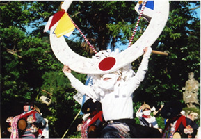
With its fertile plains, Saga Prefecture is one of the best areas of farmland in the country, leading to the development of performing arts involving Shinto rituals related to farming. Even in modern times, the area has maintained a relative level of coexistence with nature. There have been no great changes to its traditional performing arts, which are still maintained today in rural communities.
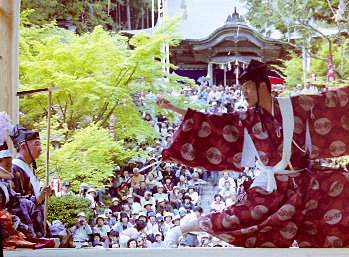
The Onda Festival is held once every 12 years, in the Chinese zodiac year of the monkey. Held at Niiyama Shrine in Kanzaki City, the ritual lasts 13 days starting from the day of the monkey in early April. It is said to come from the dengaku performances (ritual music and dancing in temples) of the Imperial Court of the Heian period (794-1185).
The performances depict rich ancient scenes of tilling rice paddies and transplanting rice seedlings, and they close with the majestic demon dance. With the protection of the Nabeshima domain during the Edo period, bumper crops were celebrated with lavish events. “The Origins of the Historic Ruins of Hizen” (compiled 1665) even includes a record of “A Buddhist memorial service that amazes all who behold it, men and women, young and old.”
“The Onda Festival (sowing seeds).”“The Onda Festival (demon dance).”
Photo courtesy of the Kanzaki-city Tourism Association.
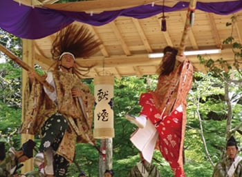
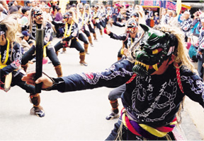
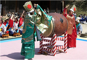
The former territory of the Nabeshima domain along the Nagasaki Kaido Road, has many such folk entertainments. This is said to be a corruption of “fuuryu” (a refined cultural pursuit). Its origins lie in cooperative Shinto and Buddhist religious festivals to pray for abundant harvests. Rice farming events are also said to have been held frequently.
There are various types of furyuu, including tentsuku (soaring) furyuu, masked furyuu, dancing and singing furyuu, and furyuu with Japanese drums. Today, depending on the area, it is used at different times of the year to offer prayers to the deities of certain shrines—in the spring to bless the upcoming harvest, for the Gion Festival in summer, or to celebrate the harvest in autumn (the Kunchi Festival).
“The soaring furyuu dance of Ichikawa (Fuji Town, Saga City).” Photo courtesy of the Saga Prefectural Tourism Federation.“The masked furyuu dance of Ureshino (Ureshino City).” Photo courtesy of the Saga Prefectural Tourism Federation.“The furyuu dance of Mateno (Sanbaso),” Photo courtesy of the Takeo City Board of Education.